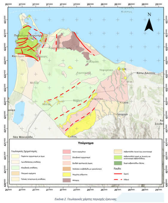
The catchment area of Peiros-Vergas-Pinios (EL02), is geologically structured by the alpine formations of the Ionian, Tripoli and Pindos geotectonic zones and by Quaternary and Neogene deposits that have covered the tectonic subsidence in the west and south of the basin. To the east of the Ionian zone, the Gavrovos-Tripoli unit is thrusted in the Ionian zone. Along the coastline the catchment area sand dune systems can be observed contributing to the development of the lakes and lagoons of the entire area.
More specifically, the following geological formations are located in the wider area:
- Ionian zone: It occurs in the area of Cape Araxos emerging from the modern deposits and includes interbedded limestones and flysch layers in the area of Lakopetra.
- Tripoli Zone: It includes a small outcrop of limestones at Mt. Scolis and extensive outcrops of sandstones and conglomerates with intrusions of flysch mudstones in the central part of the catchment area between the Piros and Pinios rivers.
- Pindos Zone: It occurs in the eastern part of the basin in a north-south arrangement and includes thin-plate limestones, cherts, and layers of flysch. The layers are strongly folded and broken.
- Metalpic formations of the Neogene and Quaternary: These formations have covered the tectonic subsidence of the Western Peloponnese. They consist of alternations of coarse (cobbles, conglomerates, sands) and fine materials (clays, marls, silts)